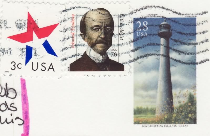

This card returned to Ana, who sent it to me. So she put it in an envelope and re-sent again. I am so glad she didn't throw it away, it is a very nice card. And I have even more beautiful stamps! Thank you, Ana! :)
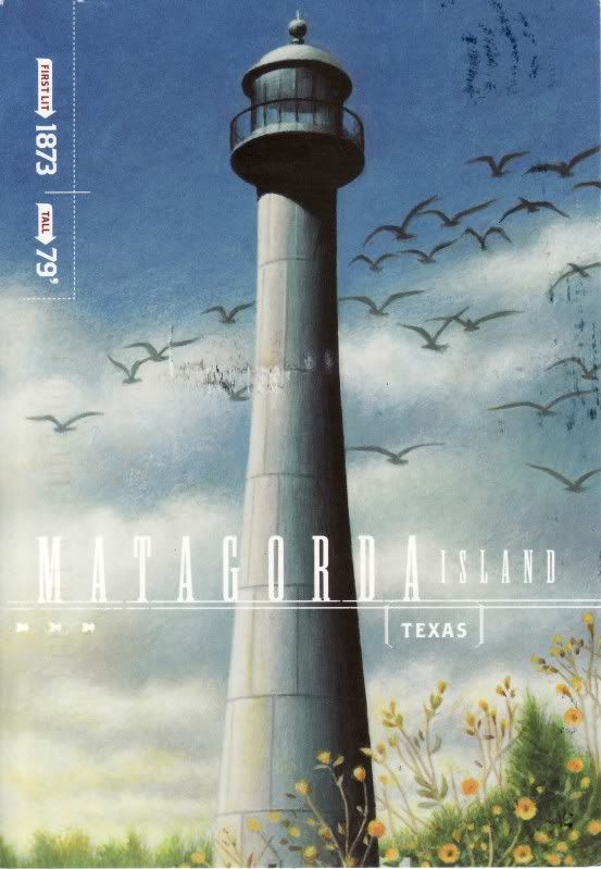
Matagorda Island, Spanish for "thick brush," is a 38 mile (61 km) long barrier island on the Texas Gulf coast, about seven miles south of Port O'Connor, in the southernmost part of Calhoun County. The island is oriented generally northeast-southwest, with the Gulf of Mexico on the east and south, and Espiritu Santo Bay on the west and north. It is separated from San José Island to the south by Cedar Bayou, and is separated from the Matagorda Peninsula to the north by Cavallo Pass. It has no permanent residents and is accessible only by private boat and passenger ferry. It has a land area of 157.25 km² (60.7 sq mi).
Matagorda Island State Park occupies 7325 acres (29.64 km²) on the northeastern end of the island. The remainder of the island is devoted to wildlife refuges managed by the Texas Parks and Wildlife Department and the United States Fish and Wildlife Service.
Listed on the National Register of Historic Places in 1984, Matagorda Island lighthouse has stood proudly for more than a century near Port O'Connor, Texas. The black conical tower - which was automated in 1956 - is made of cast iron and features a solar-powered light.
No comments:
Post a Comment